
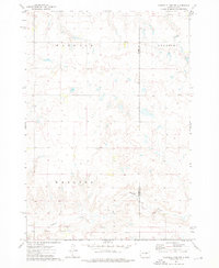
1973 Map of Chapelle Lake SW
USGS Topo · Published 1976About this map
Crow Creek Indian Reservation dominates the southern landscape of this central South Dakota quadrangle, where the boundary line cuts across the prairie just north of Chaney Rush Creek. The terrain is defined by the prominent heights of Webster Butte and Pratt Butte, which overlook a network of seasonal watercourses and drainage basins. Evidence of early rural infrastructure is found at Snake Butte Sch and the small settlement of Shaber, reflecting the localized school districts and homestead patterns that once served the families of this sparsely populated region.
Find a feature on this map
10 named features on this map. Tap any name to fly to it.
Don’t see what you’re looking for? This feature index may not catch every label — zoom into the map to look around manually.
Map Details
Editions of this 1973 Chapelle Lake SW Map
This is the sole edition of this map. No revisions or reprints were ever made.
Other maps of this area

1953 · Huron
USGS Topo · 1:250,000

1954 · Huron
USGS Topo · 1:250,000

1966 · Lower Brule NW
USGS Topo · 1:24,000

1966 · Joe Creek
USGS Topo · 1:24,000

1966 · Lower Brule NE
USGS Topo · 1:24,000

1967 · De Grey NE
USGS Topo · 1:24,000

1973 · Chapelle Lake SE
USGS Topo · 1:24,000

1973 · De Grey SE
USGS Topo · 1:24,000

1973 · Chapelle Lake
USGS Topo · 1:24,000
1973 · Chapelle Lake NW
USGS Topo · 1:24,000