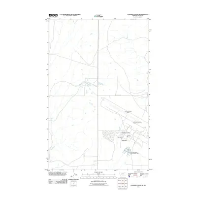
2011 Map of Chapman Coulee NE
USGS Topo · Published 2011About this map
Saint Marie serves as the primary residential and civic hub on this 2011 survey of Valley County, Montana. The town's grid is organized around streets such as Avenue D and Elm St, with local services centered on the Saint Marie Rural Fire Dist and its associated storage facility. The landscape is heavily influenced by cold-war era infrastructure repurposed for modern industry, most notably at the Glasgow Industrial Airport and the adjacent Valley Industrial Park. This industrial legacy is further evident in the large-scale utility footprints of the Vip Sewage Disposal Lagoons Number 1 Dam and its counterpart to the north. Beyond the developed zones, the terrain reverts to rangeland drained by Cherry Creek, with isolated water sources like Olson Spring and a sparse network of gravel routes including Trout Pond Rd and Shipp Rd.
Find a feature on this map
19 named features on this map. Tap any name to fly to it.
Don’t see what you’re looking for? This feature index may not catch every label — zoom into the map to look around manually.
Map Details
Editions of this 2011 Chapman Coulee NE Map
This is the sole edition of this map. No revisions or reprints were ever made.
Other maps of this area

1918 · Porcupine Valley
USGS Topo · 1:62,500

1919 · Boundary
USGS Topo · 1:125,000

1943 · Glasgow
USGS Topo · 1:125,000

1954 · Glasgow
USGS Topo · 1:250,000

1957 · Glasgow
USGS Topo · 1:250,000

1958 · Glasgow
USGS Topo · 1:250,000

1969 · Cornwell Reservoir
USGS Topo · 1:24,000

1969 · Chapman Coulee NE
USGS Topo · 1:24,000
1969 · Chapman Coulee
USGS Topo · 1:24,000

1969 · Hawk Coulee
USGS Topo · 1:24,000