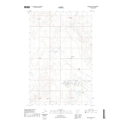
2020 Map of Chapman Coulee NE
USGS Topo · Published 2020About this map
Glasgow Industrial Airport and its surrounding street grid anchor the southeastern portion of this Valley County landscape. The area features a highly structured residential layout with streets like Poplar St, Sycamore St, and Country Club Blvd that contrast with the open Montana terrain. The geography is defined by a series of drainages, most notably Foss Coulee and School Section Coulee, which carve through the plains. Natural water sources such as Cherry Cr and Olson Spring are scattered across the quadrangle, while named routes like Trout Pond Rd and Ship Rd provide the primary connections through the township and range sections.
Find a feature on this map
37 named features on this map. Tap any name to fly to it.
Don’t see what you’re looking for? This feature index may not catch every label — zoom into the map to look around manually.
Map Details
Editions of this 2020 Chapman Coulee NE Map
This is the sole edition of this map. No revisions or reprints were ever made.
Other maps of this area

1918 · Porcupine Valley
USGS Topo · 1:62,500

1919 · Boundary
USGS Topo · 1:125,000

1943 · Glasgow
USGS Topo · 1:125,000

1954 · Glasgow
USGS Topo · 1:250,000

1957 · Glasgow
USGS Topo · 1:250,000

1958 · Glasgow
USGS Topo · 1:250,000

1969 · Cornwell Reservoir
USGS Topo · 1:24,000

1969 · Chapman Coulee NE
USGS Topo · 1:24,000
1969 · Chapman Coulee
USGS Topo · 1:24,000

1969 · Hawk Coulee
USGS Topo · 1:24,000