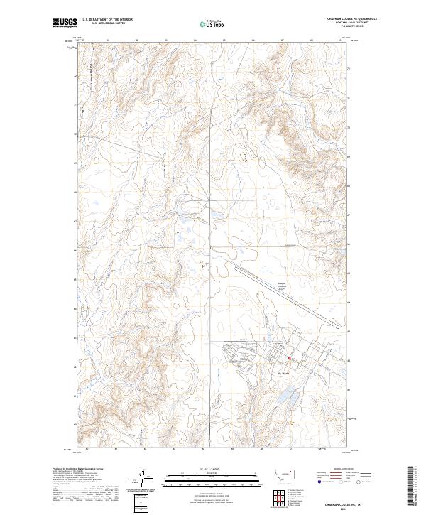
2024 Map of Chapman Coulee NE
USGS Topo · Published 2024About this map
St. Marie stands as the primary residential hub on this Valley County landscape, characterized by a structured street grid that includes Country Club Blvd, Poplar St, and Walnut ST. Adjacent to the settlement lies the Glasgow Industrial Airport, a massive facility that dominates the central-eastern portion of the sheet. The surrounding terrain is defined by its drainage patterns, with numerous coulees carving through the high plains. Notable features such as Spring Coulee, Foss Coulee, and School Section Coulee drain the landscape, while Olson Spring provides a distinct water source along Olson Spring Rd. The map illustrates the specialized infrastructure of this region, where large-scale aviation facilities meet the remote, etched topography of the Montana plains.
Find a feature on this map
38 named features on this map. Tap any name to fly to it.
Don’t see what you’re looking for? This feature index may not catch every label — zoom into the map to look around manually.
Map Details
Editions of this 2024 Chapman Coulee NE Map
This is the sole edition of this map. No revisions or reprints were ever made.
Other maps of this area

1918 · Porcupine Valley
USGS Topo · 1:62,500

1919 · Boundary
USGS Topo · 1:125,000

1943 · Glasgow
USGS Topo · 1:125,000

1954 · Glasgow
USGS Topo · 1:250,000

1957 · Glasgow
USGS Topo · 1:250,000

1958 · Glasgow
USGS Topo · 1:250,000

1969 · Cornwell Reservoir
USGS Topo · 1:24,000

1969 · Chapman Coulee NE
USGS Topo · 1:24,000
1969 · Chapman Coulee
USGS Topo · 1:24,000

1969 · Hawk Coulee
USGS Topo · 1:24,000