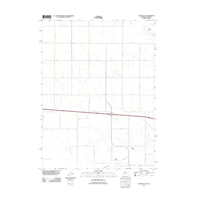
2011 Map of Chappell SE
USGS Topo · Published 2011About this map
Walrath Draw and Hartley Draw cut across this high plains landscape in Deuel County, illustrating the natural drainage patterns that define the region. The map captures a largely agricultural and rural corridor just north of the Colorado state line, where the land is organized by a strict grid of section roads including Road 18 and Road 8. Water management is central to the area's utility, evidenced by the Peterson Ditch and the State Line Ditch, which follows the political boundary. These features, along with O Neil Draw, show how early 21st-century topography remains shaped by both intermittent natural watercourses and man-made irrigation infrastructure essential for plains farming.
Find a feature on this map
21 named features on this map. Tap any name to fly to it.
Don’t see what you’re looking for? This feature index may not catch every label — zoom into the map to look around manually.
Map Details
Editions of this 2011 Chappell SE Map
This is the sole edition of this map. No revisions or reprints were ever made.
Other maps of this area

1900 · Chappell
USGS Topo · 1:125,000

1953 · Ovid
USGS Topo · 1:24,000

1953 · Julesburg
USGS Topo · 1:24,000

1954 · Sterling
USGS Topo · 1:250,000

1954 · Scottsbluff
USGS Topo · 1:250,000

1958 · Scottsbluff
USGS Topo · 1:250,000

1958 · Sterling
USGS Topo · 1:250,000

1961 · Chappell
USGS Topo · 1:24,000

1961 · Barton
USGS Topo · 1:24,000

1961 · Chappell SE
USGS Topo · 1:24,000