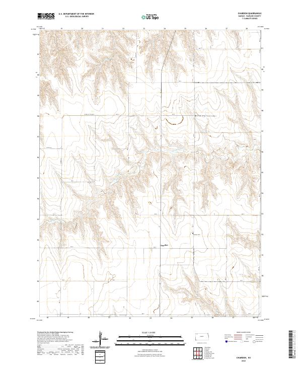
2022 Map of Chardon
USGS Topo · Published 2022About this map
Chardon stands as a quiet focal point in this portion of Rawlins County, where the high plains landscape is deeply etched by the drainage of N Fork Sappa Cr. The topography reveals a complex network of draws and ridges that define the local agricultural layout, with the section lines of the Public Land Survey System providing the primary structure for movement. A short distance east of the settlement, Chardon Cem serves as a significant landmark for those tracing local family lineages and the early homesteading history of this corner of Kansas. The road network, including routes like Co RD 417 and RD G, follows the rigid grid typical of the region, occasionally deviating to navigate the winding path of the creek and its numerous unnamed tributaries.
Find a feature on this map
27 named features on this map. Tap any name to fly to it.
Don’t see what you’re looking for? This feature index may not catch every label — zoom into the map to look around manually.
Map Details
Editions of this 2022 Chardon Map
This is the sole edition of this map. No revisions or reprints were ever made.
Other maps of this area

1951 · Herndon
USGS Topo · 1:62,500

1951 · Achilles
USGS Topo · 1:62,500

1951 · Atwood
USGS Topo · 1:62,500

1951 · Chardon
USGS Topo · 1:62,500

1954 · Goodland
USGS Topo · 1:250,000

1956 · Goodland
USGS Topo · 1:250,000

1957 · Goodland
USGS Topo · 1:250,000

1978 · Long Draw South
USGS Topo · 1:24,000
1978 · Beardsley
USGS Topo · 1:24,000
1978 · Atwood
USGS Topo · 1:24,000