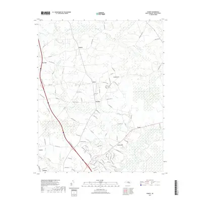
2019 Map of Charity
USGS Topo · Published 2019About this map
The Northeast Cape Fear River defines the southeastern corner of this modern North Carolina landscape, where numerous tributaries like Island Cr and Maxwell Cr feed into the broader coastal plain drainage. This region is characterized by a dense network of family-named roads and small rural settlements, reflecting a deeply established local heritage. Key population centers including Rose Hill, Wallace, and Teachey are positioned along major transit corridors, while smaller communities such as Charity, Murphey, and Register represent the agricultural backbone of Duplin County. Genealogists may find particular interest in the Clay Hill Cem near the center of the map, as well as the numerous family-named landmarks like John Stanley Bostic Rd and Minnie Farrior Rd that offer clues to the land-ownership patterns of the area.
Find a feature on this map
93 named features on this map. Tap any name to fly to it.
Don’t see what you’re looking for? This feature index may not catch every label — zoom into the map to look around manually.
Map Details
Editions of this 2019 Charity Map
This is the sole edition of this map. No revisions or reprints were ever made.
Other maps of this area

1942 · Burgaw
USGS Topo · 1:62,500

1943 · Kenansville
USGS Topo · 1:62,500

1948 · Kenansville
USGS Topo · 1:62,500

1953 · Florence
USGS Topo · 1:250,000

1953 · Beaufort
USGS Topo · 1:250,000

1954 · Florence
USGS Topo · 1:250,000

1954 · Beaufort
USGS Topo · 1:250,000

1955 · Atkinson
USGS Topo · 1:62,500

1962 · Rose Hill
USGS Topo · 1:62,500

1972 · Beaufort
USGS Topo · 1:250,000