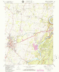
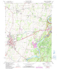
1978 Map of Charles Town
USGS Topo · Published 1987About this map
The confluence of the Potomac River and Shenandoah River anchor this late-1970s survey of the Eastern Panhandle, where West Virginia meets Maryland and Virginia. Industrial and historical legacies converge at Harpers Ferry, bounded by the Chesapeake and Ohio Canal Nat Hist Park and the preserved grounds of Harpers Ferry Nat Hist Park. The landscape is defined by its transit corridors, from the heavy rail lines of the Baltimore and Ohio Railroad and Norfolk and Western to the winding Appalachian Trail traversing the Blue Ridge. Westward, the settlement of Charles Town and its sister city Ranson show significant development, including the Shenandoah Downs racetrack and the Page-Jackson Sch. Between these hubs, the terrain is marked by limestone Quarries and water features like Flowing Springs, reflecting a rural economy shifting toward light industry and suburban growth.
Find a feature on this map
87 named features on this map. Tap any name to fly to it.
Don’t see what you’re looking for? This feature index may not catch every label — zoom into the map to look around manually.
Map Details
Editions of this 1978 Charles Town Map
5 editions found
Other maps of this area

1884 · Harpers Ferry
USGS Topo · 1:125,000

1891 · Harpers Ferry
USGS Topo · 1:125,000

1893 · Harpers Ferry
USGS Topo · 1:125,000

1908 · Middletown
USGS Topo · 1:48,000

1910 · Antietam
USGS Topo · 1:62,500

1914 · Martinsburg
USGS Topo · 1:48,000

1916 · Martinsburg
USGS Topo · 1:62,500

1916 · Berryville
USGS Topo · 1:62,500

1939 · Berryville
USGS Topo · 1:48,000
1944 · Round Hill
USGS Topo · 1:31,680