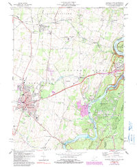
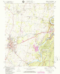
1978 Map of Charles Town
USGS Topo · Published 1991About this map
The Shenandoah River and Potomac River converge at the historic meeting point of West Virginia, Maryland, and Virginia, anchoring a landscape shaped by early transport and industry. The lower Shenandoah Valley here is dominated by the twin cities of Charles Town and Ranson, with the Charles Town Racetrack serving as a major local landmark. To the northeast, the heights of Harpers Ferry look down upon the confluence and the C & O Canal, where Lock No. 35 and Lock No. 36 remain as evidence of the nineteenth-century waterway economy.
Find a feature on this map
87 named features on this map. Tap any name to fly to it.
Don’t see what you’re looking for? This feature index may not catch every label — zoom into the map to look around manually.
Map Details
Editions of this 1978 Charles Town Map
5 editions found
Other maps of this area

1884 · Harpers Ferry
USGS Topo · 1:125,000

1891 · Harpers Ferry
USGS Topo · 1:125,000

1893 · Harpers Ferry
USGS Topo · 1:125,000

1908 · Middletown
USGS Topo · 1:48,000

1910 · Antietam
USGS Topo · 1:62,500

1914 · Martinsburg
USGS Topo · 1:48,000

1916 · Martinsburg
USGS Topo · 1:62,500

1916 · Berryville
USGS Topo · 1:62,500

1939 · Berryville
USGS Topo · 1:48,000
1944 · Round Hill
USGS Topo · 1:31,680