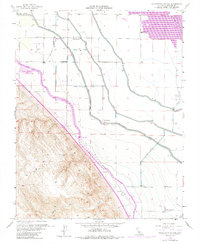
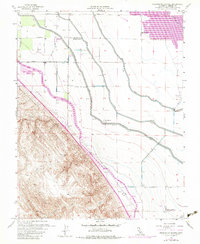
1956 Map of Charleston School
USGS Topo · Published 1988About this map
Agricultural development and massive water infrastructure define this central California landscape at the midpoint of the twentieth century. The Delta-Mendota Canal and the California Aqueduct dominate the terrain, illustrating the engineering scale required to sustain the region's farms. Near the intersection of Mervel Ave and local access roads, the namesake Charleston Sch stands as a focal point for the rural community. To the north, the presence of the Duck Ponds and several private organizations, including the Santa Cruz Gun Club and Brite Gun Club, indicates a landscape shared between industrial-scale farming and recreational marshland use. The transition from the flatlands to the foothills is marked by the Dos Amigos Pumping Plant, which anchors the water system near the rugged slopes of White VABM 829.
Find a feature on this map
22 named features on this map. Tap any name to fly to it.
Don’t see what you’re looking for? This feature index may not catch every label — zoom into the map to look around manually.
Map Details
Editions of this 1956 Charleston School Map
5 editions found
Other maps of this area

1913 · Panoche
USGS Topo · 1:125,000

1916 · Delta Ranch
USGS Topo · 1:24,000

1920 · Carrisalito Spring
USGS Topo · 1:31,680

1921 · Volta
USGS Topo · 1:31,680

1921 · Los Banos
USGS Topo · 1:31,680

1921 · Laguna Seca Ranch
USGS Topo · 1:31,680

1922 · Charleston School
USGS Topo · 1:31,680

1922 · Dos Palos
USGS Topo · 1:31,680

1922 · Ortigalita
USGS Topo · 1:31,680
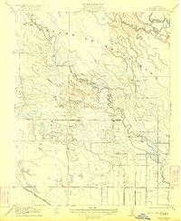
1922 · Delta Ranch
USGS Topo · 1:31,680