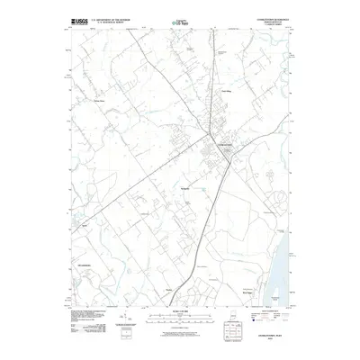
2010 Map of Charlestown
USGS Topo · Published 2010About this map
The Charlestown and Sellersburg area in southern Indiana is depicted here as it sat in 2010, showing the expansion of residential developments and industrial corridors like River Ridge near the Ohio River. The landscape is a network of small creeks and runs, including Sinking Fork, Pleasant Run, and Fourteenmile Creek, which have historically shaped the settlement patterns of towns like Speed and Springville. Local history and genealogy are well-represented by numerous family and community burial grounds, such as Robinson Cemetery, Bottorff Cemetery, and the curiously named Fifty-four Cemetery near the riverbank. Along the southern edge of the sheet, the river terrain includes Twelvemile Island, while the interior shows the infrastructure of the Charlestown Post Office and local landmarks like Lake Joyce.
Find a feature on this map
79 named features on this map. Tap any name to fly to it.
Don’t see what you’re looking for? This feature index may not catch every label — zoom into the map to look around manually.
Map Details
Editions of this 2010 Charlestown Map
This is the sole edition of this map. No revisions or reprints were ever made.
Other maps of this area

1905 · Prospect
USGS Topo · 1:62,500

1912 · Prospect
USGS Topo · 1:62,500

1937 · Jeffersonville
USGS Topo · 1:24,000

1937 · Charlestown
USGS Topo · 1:24,000

1938 · Owen
USGS Topo · 1:24,000

1938 · Speed
USGS Topo · 1:24,000

1939 · New Albany
USGS Topo · 1:24,000

1946 · Jeffersonville
USGS Topo · 1:24,000

1946 · New Albany
USGS Topo · 1:24,000

1947 · Speed
USGS Topo · 1:24,000