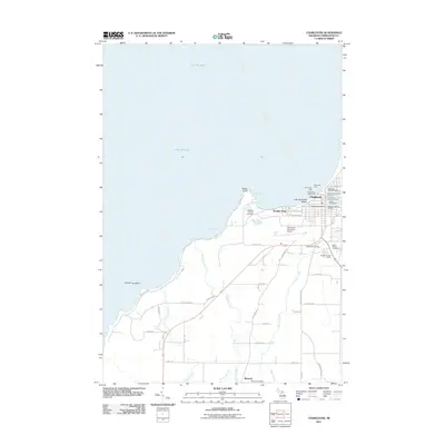
2011 Map of Charlevoix
USGS Topo · Published 2011About this map
The northern Michigan coastline and the harbor at Charlevoix are the central focus of this 2011 survey, showing a landscape defined by its maritime infrastructure and industrial legacy. The Charlevoix Lighthouse and both the North Pier Light and South Pier Light guard the entrance to the channel, which serves the Beaver Island Boat Company and the Charlevoix Municipal Dock. This survey documents the intersection of leisure and industry, where the residential enclave of Boulder Park sits just north of the significant industrial footprint of the Medusa Cement Company at Port Medusa.
Find a feature on this map
51 named features on this map. Tap any name to fly to it.
Don’t see what you’re looking for? This feature index may not catch every label — zoom into the map to look around manually.
Map Details
Editions of this 2011 Charlevoix Map
This is the sole edition of this map. No revisions or reprints were ever made.
Other maps of this area

1954 · Central Lake
USGS Topo · 1:62,500

1954 · Charlevoix
USGS Topo · 1:62,500

1955 · Cheboygan
USGS Topo · 1:250,000

1958 · Cheboygan
USGS Topo · 1:250,000

1958 · Bayshore
USGS Topo · 1:62,500

1961 · Boyne City
USGS Topo · 1:62,500

1975 · Boyne City NW
USGS Topo · 1:24,000
1983 · Ellsworth
USGS Topo · 1:25,000
1983 · Atwood
USGS Topo · 1:24,000
1983 · Charlevoix
USGS Topo · 1:25,000