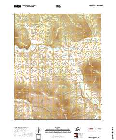
2018 Map of Charley River D-2 NE
USGS Topo · Published 2018About this map
Wood River winds through the central portion of this interior Alaska wilderness, serving as the primary hydrological feature within a landscape defined by significant topographic variation. The terrain rises sharply toward the northern and southern boundaries of the quadrangle, with elevation contours indicating steep ridges and peaks that flank the river valley. The absence of road infrastructure or named settlements reflects the isolated character of the Yukon-Koyukuk region, where the natural drainage of the Wood River and the high mountain slopes dictate the geography. This map preserves the spatial arrangement of these remote landforms as recorded in the late 2010s.
Find a feature on this map
7 named features on this map. Tap any name to fly to it.
Don’t see what you’re looking for? This feature index may not catch every label — zoom into the map to look around manually.
Map Details
Editions of this 2018 Charley River D-2 NE Map
This is the sole edition of this map. No revisions or reprints were ever made.
Other maps of this area

1951 · Charley River
USGS Topo · 1:250,000

1951 · Black River
USGS Topo · 1:250,000
1956 · Black River A-1
USGS Topo · 1:63,360

1956 · Black River A-2
USGS Topo · 1:63,360

1956 · Black River
USGS Topo · 1:250,000

1956 · Charley River D-2
USGS Topo · 1:63,360
1956 · Charley River D-1
USGS Topo · 1:63,360

1956 · Charley River
USGS Topo · 1:250,000

1964 · Black River
USGS Topo · 1:250,000
2018 · Black River A-1 SW
USGS Topo · 1:25,000