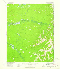
1956 Map of Black River A-1
USGS Topo · Published 1959About this map
Grayling Fork Black River meanders across this interior landscape, a remote stretch of the Alaska-Yukon frontier documented in the late 1950s. The topography is defined by the elevation gains toward the international border, where peaks like Steamboat Mountain and Midnight Hill overlook the winding drainage systems of Tikan Creek. The map records the precise boundary line between the United States and Canada, as established by the International Boundary Commission. This survey captures a moment before modern infrastructure, showing an area devoid of named roads or settlements, where the terrain is governed entirely by the natural watercourses and the stark relief of the eastern Alaskan wilderness.
Find a feature on this map
6 named features on this map. Tap any name to fly to it.
Don’t see what you’re looking for? This feature index may not catch every label — zoom into the map to look around manually.
Map Details
Editions of this 1956 Black River A-1 Map
3 editions found
Other maps of this area

1951 · Charley River
USGS Topo · 1:250,000

1951 · Black River
USGS Topo · 1:250,000

1956 · Black River A-2
USGS Topo · 1:63,360

1956 · Black River B-2
USGS Topo · 1:63,360

1956 · Black River B-1
USGS Topo · 1:63,360

1956 · Black River
USGS Topo · 1:250,000

1956 · Charley River D-2
USGS Topo · 1:63,360
1956 · Charley River D-1
USGS Topo · 1:63,360

1956 · Charley River
USGS Topo · 1:250,000

1964 · Black River
USGS Topo · 1:250,000