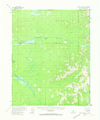
1956 Map of Black River A-1
USGS Topo · Published 1973About this map
Grayling Fork Black River cuts a winding path across this interior Alaskan wilderness, defining a landscape dominated by expansive wetlands and isolated summits. The drainage network is further defined by the convergence of Bull Creek and Tikan Creek, where the terrain transitions from low-lying swamps to prominent high points like Steamboat Mountain and Midnight Hill. This 1956 survey captures a remote frontier along the Alaska Yukon border, where the land remains largely unorganized and unsurveyed. The topography reflects a pristine subarctic environment, with the United States Canada boundary line serving as the primary man-made feature in an area otherwise shaped by hydraulic patterns and glacial relief.
Find a feature on this map
7 named features on this map. Tap any name to fly to it.
Don’t see what you’re looking for? This feature index may not catch every label — zoom into the map to look around manually.
Map Details
Editions of this 1956 Black River A-1 Map
3 editions found
Other maps of this area

1951 · Charley River
USGS Topo · 1:250,000

1951 · Black River
USGS Topo · 1:250,000
1956 · Black River A-1
USGS Topo · 1:63,360

1956 · Black River A-2
USGS Topo · 1:63,360

1956 · Black River B-2
USGS Topo · 1:63,360

1956 · Black River B-1
USGS Topo · 1:63,360

1956 · Black River
USGS Topo · 1:250,000

1956 · Charley River D-2
USGS Topo · 1:63,360
1956 · Charley River D-1
USGS Topo · 1:63,360

1956 · Charley River
USGS Topo · 1:250,000