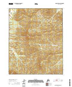
2018 Map of Charley River D-4 NW
USGS Topo · Published 2018About this map
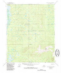
Bear Mtn rises as a prominent landmark in this corner of the Yukon-Koyukuk Census Area, defining a high-elevation landscape where water drainages carve deeply through the terrain. The northern slopes of this massif are the source for Bear Mountain Cr, which flows through the eastern portion of the quadrangle. This 2018 survey primarily documents the complex topography and section lines of the Public Land Survey System, including parts of t14n r23e, t13n r23e, and surrounding townships. The map is a study in natural hydrology and elevation, showing how small stream networks organize the remote interior of Alaska's eastern regions before they reach larger river systems. It offers a detailed look at the physical geography of the Bear Mtn vicinity during the early 21st century.
Find a feature on this map
10 named features on this map. Tap any name to fly to it.
Don’t see what you’re looking for? This feature index may not catch every label — zoom into the map to look around manually.
Map Details
Editions of this 2018 Charley River D-4 NW Map
This is the sole edition of this map. No revisions or reprints were ever made.
Other maps of this area

1951 · Charley River
USGS Topo · 1:250,000

1951 · Black River
USGS Topo · 1:250,000

1956 · Black River A-4
USGS Topo · 1:63,360
1956 · Black River A-5
USGS Topo · 1:63,360
1956 · Charley River D-4
USGS Topo · 1:63,360
1956 · Charley River D-5
USGS Topo · 1:63,360

1956 · Black River
USGS Topo · 1:250,000

1956 · Charley River
USGS Topo · 1:250,000

1964 · Black River
USGS Topo · 1:250,000
1984 · Black River A-4
USGS Topo · 1:63,360