
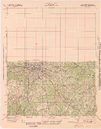
1942 Map of Charlotte
USGS Topo · Published 1942About this map
Charlotte sits at the heart of this wartime landscape, a bustling transportation hub defined by the intersecting lines of the Southern and Seaboard Air Line railroads. The map captures the city just as its mid-century expansion was taking hold, with established green spaces like Revolution Park and Meyers Park providing structure to the urban core. Surrounding the city, a constellation of smaller settlements and crossroads like Chadwick Hoskins, Dixie, and Hoods Cross Road reveal the transition from industrial outskirts to the rural piedmont.
Find a feature on this map
43 named features on this map. Tap any name to fly to it.
Don’t see what you’re looking for? This feature index may not catch every label — zoom into the map to look around manually.
Map Details
Editions of this 1942 Charlotte Map
2 editions found
Other maps of this area

1893 · Statesville
USGS Topo · 1:125,000

1895 · Hickory
USGS Topo · 1:125,000

1905 · Charlotte
USGS Topo · 1:48,000

1907 · Charlotte
USGS Topo · 1:62,500

1914 · Gastonia
USGS Topo · 1:48,000

1916 · Gastonia
USGS Topo · 1:62,500

1941 · Charlotte
USGS Topo · 1:125,000

1941 · Spartanburg
USGS Topo · 1:250,000

1947 · Clover
USGS Topo · 1:62,500

1948 · Paw Creek
USGS Topo · 1:24,000