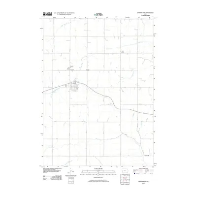
2010 Map of Charter Oak
USGS Topo · Published 2010About this map
Charter Oak serves as the central hub of this Crawford County landscape, where the town grid is defined by the Charter Oak Post Office and nearby community landmarks. The surrounding agricultural terrain is deeply etched by the drainage of the Middle Soldier River and East Soldier River, with smaller tributaries like Emigrant Creek cutting through the section lines. This area preserves a significant genealogical record through its numerous burial grounds, including the Saint John Cemetery, Saint Boniface Cemetery, and the Charter Oak Cemetery clustered near the main settlement. Further east, the Bockelmann Family Cemetery sits among the farmsteads, illustrating the private family legacies typical of rural Iowa. To the southeast, the small settlement of Kenwood marks the transition toward Willow Creek, anchored by a network of gravel roads such as Kenwood Rd and 180th St.
Find a feature on this map
28 named features on this map. Tap any name to fly to it.
Don’t see what you’re looking for? This feature index may not catch every label — zoom into the map to look around manually.
Map Details
Editions of this 2010 Charter Oak Map
This is the sole edition of this map. No revisions or reprints were ever made.
Other maps of this area

1954 · Omaha
USGS Topo · 1:250,000

1954 · Fort Dodge
USGS Topo · 1:250,000

1957 · Omaha
USGS Topo · 1:250,000

1957 · Fort Dodge
USGS Topo · 1:250,000

1958 · Omaha
USGS Topo · 1:250,000

1958 · Fort Dodge
USGS Topo · 1:250,000

1969 · Danbury
USGS Topo · 1:24,000

1971 · Ricketts
USGS Topo · 1:24,000

1971 · Ute
USGS Topo · 1:24,000

1971 · Schleswig
USGS Topo · 1:24,000