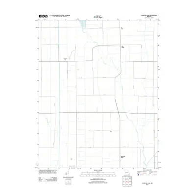
2012 Map of Charter Oak
USGS Topo · Published 2012About this map
Charter Oak sits in the flat landscape of Stoddard County, Missouri, where a network of county roads like Co RD 795 and Co RD 828 define a grid of agricultural parcels. This 2012 survey illustrates a terrain deeply influenced by local water management, with the winding paths of the Little River and the Upper Castor River cutting through the lowlands. The geography is punctuated by slight elevations known as Big Ridge and Hurricane Ridge, which historically provided the dry ground necessary for development in this river-bottom region.
Find a feature on this map
30 named features on this map. Tap any name to fly to it.
Don’t see what you’re looking for? This feature index may not catch every label — zoom into the map to look around manually.
Map Details
Editions of this 2012 Charter Oak Map
This is the sole edition of this map. No revisions or reprints were ever made.
Other maps of this area

1931 · Sikeston
USGS Topo · 1:62,500

1934 · Bloomfield
USGS Topo · 1:62,500

1934 · Sikeston
USGS Topo · 1:62,500

1939 · Bloomfield
USGS Topo · 1:62,500

1939 · Sikeston
USGS Topo · 1:62,500

1939 · New Madrid
USGS Topo · 1:62,500

1940 · Malden
USGS Topo · 1:62,500

1949 · Bloomfield
USGS Topo · 1:62,500

1951 · New Madrid SE
USGS Topo · 1:24,000

1954 · New Madrid
USGS Topo · 1:62,500