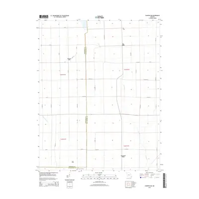
2015 Map of Charter Oak
USGS Topo · Published 2015About this map
Charter Oak occupies a central position on this Southeast Missouri landscape, situated near the intersection of Mo-A and Locust St. The geography is defined by subtle topographic rises known as ridges, which likely historically provided high ground in this lowland region. These features, including Big Ridge, Hurricane Ridge, and Cane Ridge, stand out against the surrounding drainage network formed by the Little River and the Upper Castor River. The map meticulously details the county boundary separating Stoddard Co and New Madrid Co, illustrating how local jurisdictions bisect the rural landscape. For those researching family history in the Bootheel, the presence of Simmons Cemetery near the southern border offers a specific point of reference for genealogical study within this grid-based agricultural area.
Find a feature on this map
42 named features on this map. Tap any name to fly to it.
Don’t see what you’re looking for? This feature index may not catch every label — zoom into the map to look around manually.
Map Details
Editions of this 2015 Charter Oak Map
This is the sole edition of this map. No revisions or reprints were ever made.
Other maps of this area

1931 · Sikeston
USGS Topo · 1:62,500

1934 · Bloomfield
USGS Topo · 1:62,500

1934 · Sikeston
USGS Topo · 1:62,500

1939 · Bloomfield
USGS Topo · 1:62,500

1939 · Sikeston
USGS Topo · 1:62,500

1939 · New Madrid
USGS Topo · 1:62,500

1940 · Malden
USGS Topo · 1:62,500

1949 · Bloomfield
USGS Topo · 1:62,500

1951 · New Madrid SE
USGS Topo · 1:24,000

1954 · New Madrid
USGS Topo · 1:62,500