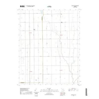
2017 Map of Charter Oak
USGS Topo · Published 2017About this map
Charter Oak sits at the center of this agricultural landscape in the Missouri Bootheel, where the border between Stoddard Co and New Madrid Co is defined by a perfectly straight north-south survey line. The terrain is characterized by subtle elevation changes that were historically significant for settlement in this low-lying region, including Big Ridge to the north and Cane Ridge to the south. These higher ground features provided refuge in a territory defined by complex drainage systems. The Little River meanders through the eastern half of the map, while the Upper Castor River appears in the southwest corner. Transportation is dictated by a rigid grid of county roads, such as Co Rd 797 and Co Rd 750, punctuated by regional arteries like State Hwy E. For genealogists, the placement of Simmons Cem near the southern boundary provides a specific point of interest for family research.
Find a feature on this map
41 named features on this map. Tap any name to fly to it.
Don’t see what you’re looking for? This feature index may not catch every label — zoom into the map to look around manually.
Map Details
Editions of this 2017 Charter Oak Map
This is the sole edition of this map. No revisions or reprints were ever made.
Other maps of this area

1931 · Sikeston
USGS Topo · 1:62,500

1934 · Bloomfield
USGS Topo · 1:62,500

1934 · Sikeston
USGS Topo · 1:62,500

1939 · Bloomfield
USGS Topo · 1:62,500

1939 · Sikeston
USGS Topo · 1:62,500

1939 · New Madrid
USGS Topo · 1:62,500

1940 · Malden
USGS Topo · 1:62,500

1949 · Bloomfield
USGS Topo · 1:62,500

1951 · New Madrid SE
USGS Topo · 1:24,000

1954 · New Madrid
USGS Topo · 1:62,500