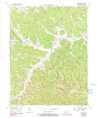
1949 Map of Charters
USGS Topo · Published 1991About this map
Charters and Clarksburg serve as the primary hubs of activity in this Lewis County landscape, where winding hollows and steep ridges dictate the pattern of human settlement. Following the course of Salt Lick Creek, the community of Charters is situated near the Valley Sch and the Valley Cem, reflecting a classic Appalachian valley-bottom development. The terrain is defined by prominent elevations such as Pleasant Ridge and Eskalapia Mtn, which separate the various watersheds feeding into the creek.
Find a feature on this map
83 named features on this map. Tap any name to fly to it.
Don’t see what you’re looking for? This feature index may not catch every label — zoom into the map to look around manually.
Map Details
Editions of this 1949 Charters Map
3 editions found
Other maps of this area

1919 · Vanceburg
USGS Topo · 1:62,500

1929 · Springdale
USGS Topo · 1:48,000

1935 · Springdale
USGS Topo · 1:62,500

1949 · Vanceburg
USGS Topo · 1:62,500

1949 · Buena Vista
USGS Topo · 1:24,000

1949 · Vanceburg
USGS Topo · 1:24,000

1949 · Concord
USGS Topo · 1:24,000

1949 · Charters
USGS Topo · 1:24,000

1950 · Charters
USGS Topo · 1:24,000

1950 · Head Of Grassy
USGS Topo · 1:24,000