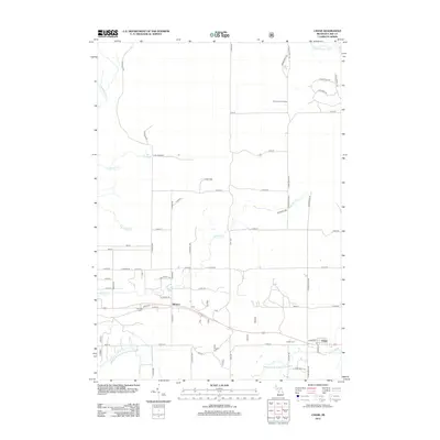
2012 Map of Chase
USGS Topo · Published 2012About this map
The Middle Br Pere Marquette River and the Little Manistee River define the hydraulic character of this Lake County landscape, where the settlements of Chase and Nirvana serve as primary hubs. In the early 21st century, these rural communities remain anchored by local landmarks such as the Nirvana Cem and Chase Cem. The terrain is marked by a network of creeks, including Sanborn Cr and N Br Cole Cr, which feed into the larger river systems. Elevated points are indicated by the presence of the Pinora Lookout Tower in the north-central region. Transport is facilitated by local routes such as S Kings Hwy and S Queens Hwy, connecting the dispersed residences and small water bodies like Totten Lake and Big Spring.
Find a feature on this map
57 named features on this map. Tap any name to fly to it.
Don’t see what you’re looking for? This feature index may not catch every label — zoom into the map to look around manually.
Map Details
Editions of this 2012 Chase Map
This is the sole edition of this map. No revisions or reprints were ever made.
Other maps of this area

1931 · Chase NE
USGS Topo · 1:31,680

1931 · Baldwin NE
USGS Topo · 1:31,680

1932 · Chase NW
USGS Topo · 1:31,680

1933 · Peacock SE
USGS Topo · 1:31,680

1933 · Luther SE
USGS Topo · 1:31,680

1933 · Luther SW
USGS Topo · 1:31,680

1954 · Traverse City
USGS Topo · 1:250,000

1954 · Midland
USGS Topo · 1:250,000

1957 · Luther
USGS Topo · 1:62,500

1957 · Wellston
USGS Topo · 1:62,500