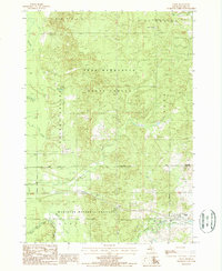
1987 Map of Chase
USGS Topo · Published 1987About this map
Cherry Valley forms a central geographic axis in this Lake County landscape, where the northern timberlands meet the headwaters of several significant Michigan waterways. The area is defined by the winding course of the Middle Branch Pere Marquette River and the Little Manistee River, reflecting a region dominated by the Pere Marquette State Forest and the Manistee National Forest. Small settlements like Chase and Nirvana are positioned along the southern transit corridor, with the latter featuring a local Cem and Roadside Park.
Find a feature on this map
22 named features on this map. Tap any name to fly to it.
Don’t see what you’re looking for? This feature index may not catch every label — zoom into the map to look around manually.
Map Details
Editions of this 1987 Chase Map
This is the sole edition of this map. No revisions or reprints were ever made.
Other maps of this area

1931 · Chase NE
USGS Topo · 1:31,680

1931 · Baldwin NE
USGS Topo · 1:31,680

1932 · Chase NW
USGS Topo · 1:31,680

1933 · Peacock SE
USGS Topo · 1:31,680

1933 · Luther SE
USGS Topo · 1:31,680

1933 · Luther SW
USGS Topo · 1:31,680

1954 · Traverse City
USGS Topo · 1:250,000

1954 · Midland
USGS Topo · 1:250,000

1957 · Luther
USGS Topo · 1:62,500

1957 · Wellston
USGS Topo · 1:62,500