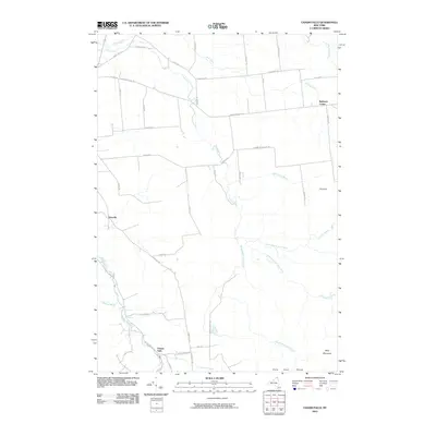
2010 Map of Chasm Falls
USGS Topo · Published 2010About this map
Chasm Falls and Bellmont Center anchor this landscape in northern New York, where the drainage of the Salmon River and the branching reaches of the Trout River define the local geography. The map documents a rural transition zone where the northern Adirondack foothills meet the agricultural plains of Franklin County. Significant terrain features such as the Owls Head Range, Pinnacle, and West Mountain rise in the south and east, while the valley floors are intersected by numerous small waterways like Winslow Brook and Fishpole Outlet. Local history is visible in the network of established thoroughfares such as French Settlement Rd and Brick Church Rd, which trace the paths of early communities like Teboville. This record of the modern era preserves the alignment of regional routes like Co Hwy 24 alongside more remote tracks like Trail Rd.
Find a feature on this map
49 named features on this map. Tap any name to fly to it.
Don’t see what you’re looking for? This feature index may not catch every label — zoom into the map to look around manually.
Map Details
Editions of this 2010 Chasm Falls Map
This is the sole edition of this map. No revisions or reprints were ever made.
Other maps of this area

1906 · Loon Lake
USGS Topo · 1:62,500

1908 · Loon Lake
USGS Topo · 1:62,500

1915 · Chateaugay
USGS Topo · 1:62,500

1915 · Malone
USGS Topo · 1:62,500

1917 · Malone
USGS Topo · 1:62,500

1921 · Santa Clara
USGS Topo · 1:62,500

1923 · Santa Clara
USGS Topo · 1:62,500

1943 · Chateaugay
USGS Topo · 1:62,500

1948 · Ogdensburg
USGS Topo · 1:250,000

1951 · Ogdensburg
USGS Topo · 1:250,000