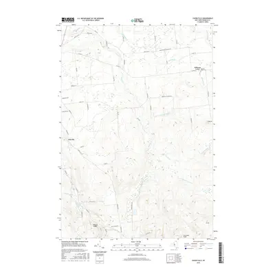
2016 Map of Chasm Falls
USGS Topo · Published 2016About this map
Bellmont Center and Chasm Falls anchor this portion of Franklin County, where the landscape is defined by the intricate drainage of the Adirondack foothills. The northern reaches are characterized by a network of rural roads such as Stacy Rd and Donohue Rd, which serve small clusters of development like Teboville. The hydrological complexity is evident in the multiple branches of the Trout River, including its East, West, and Middle branches, which converge as they flow northward through the terrain.
Find a feature on this map
59 named features on this map. Tap any name to fly to it.
Don’t see what you’re looking for? This feature index may not catch every label — zoom into the map to look around manually.
Map Details
Editions of this 2016 Chasm Falls Map
This is the sole edition of this map. No revisions or reprints were ever made.
Other maps of this area

1906 · Loon Lake
USGS Topo · 1:62,500

1908 · Loon Lake
USGS Topo · 1:62,500

1915 · Chateaugay
USGS Topo · 1:62,500

1915 · Malone
USGS Topo · 1:62,500

1917 · Malone
USGS Topo · 1:62,500

1921 · Santa Clara
USGS Topo · 1:62,500

1923 · Santa Clara
USGS Topo · 1:62,500

1943 · Chateaugay
USGS Topo · 1:62,500

1948 · Ogdensburg
USGS Topo · 1:250,000

1951 · Ogdensburg
USGS Topo · 1:250,000