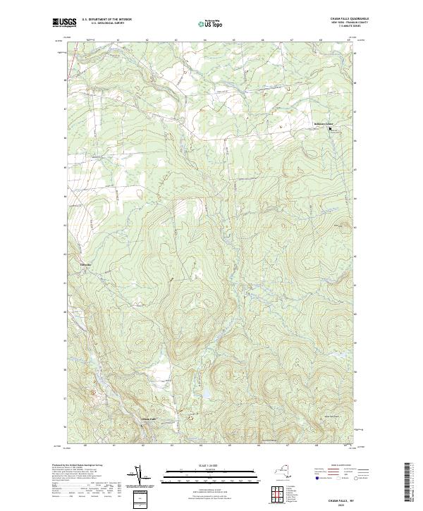
2023 Map of Chasm Falls
USGS Topo · Published 2023About this map
Chasm Falls and the surrounding Adirondack foothills are defined by the intricate headwaters of the north-flowing Trout River system. The landscape transition from the high elevations of the Owls Head Range and West Mountain down to the agricultural valleys is marked by a network of rural roads such as Brick Church Rd and Teboville Rd. Local history is centered on small hamlets like Bellmont Center, where the Bellmont Center Cem remains a primary genealogical landmark near Collins Brook. The hydrology here is complex, featuring the East Branch, Middle Branch, and West Branch Trout River, alongside the Salmon River which cuts through the southwestern corner. These watercourses and their associated wetlands like the Fishpole Outlet historically dictated the placement of early settlements and the winding paths of the township's primary transit corridors.
Find a feature on this map
55 named features on this map. Tap any name to fly to it.
Don’t see what you’re looking for? This feature index may not catch every label — zoom into the map to look around manually.
Map Details
Editions of this 2023 Chasm Falls Map
This is the sole edition of this map. No revisions or reprints were ever made.
Other maps of this area

1906 · Loon Lake
USGS Topo · 1:62,500

1908 · Loon Lake
USGS Topo · 1:62,500

1915 · Chateaugay
USGS Topo · 1:62,500

1915 · Malone
USGS Topo · 1:62,500

1917 · Malone
USGS Topo · 1:62,500

1921 · Santa Clara
USGS Topo · 1:62,500

1923 · Santa Clara
USGS Topo · 1:62,500

1943 · Chateaugay
USGS Topo · 1:62,500

1948 · Ogdensburg
USGS Topo · 1:250,000

1951 · Ogdensburg
USGS Topo · 1:250,000