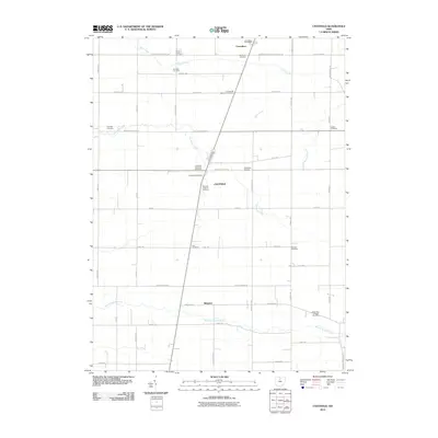
2010 Map of Chatfield
USGS Topo · Published 2010About this map
Chatfield and the surrounding townships in Crawford County display a landscape defined by an orderly grid of rural roads and scattered family-named cemeteries. This agricultural stretch in northern Ohio is punctuated by the small settlements of Carrothers and Ridgeton, which sit along the established corridors of S Township Road 187 and Ridgeton-Annapolis Rd. The map reveals a high density of small burial grounds, such as the Kennedy Cemetery, Buchman Cemetery, and Lust Cemetery, which are vital for genealogical research and tracing the early settlers of the region.
Find a feature on this map
49 named features on this map. Tap any name to fly to it.
Don’t see what you’re looking for? This feature index may not catch every label — zoom into the map to look around manually.
Map Details
Editions of this 2010 Chatfield Map
This is the sole edition of this map. No revisions or reprints were ever made.
Other maps of this area

1906 · Sycamore
USGS Topo · 1:62,500

1906 · Tiffin
USGS Topo · 1:62,500

1915 · Siam
USGS Topo · 1:62,500

1915 · Bucyrus
USGS Topo · 1:62,500

1943 · Bucyrus
USGS Topo · 1:62,500

1950 · Marion
USGS Topo · 1:250,000

1956 · Toledo
USGS Topo · 1:250,000

1960 · North Robinson
USGS Topo · 1:24,000

1960 · Oceola
USGS Topo · 1:24,000
1960 · Bloomville
USGS Topo · 1:24,000