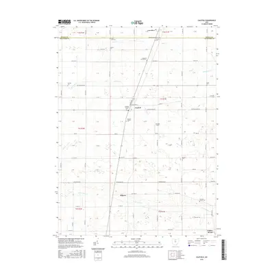
2016 Map of Chatfield
USGS Topo · Published 2016About this map
Carrothers and the surrounding agricultural landscape of northern Crawford County are defined by a meticulous grid of township roads and the meandering paths of several significant creeks. The area is anchored by the community of Chatfield, where the Chatfield Township Hall serves as a central landmark near the intersection of Sandusky Ave and Washington St. A high density of rural burial grounds, including the North Union Cem and Nazareth Lutheran Cem, provides a detailed record of the families who settled this fertile territory. In the southern portion of the sheet, the village of Ridgeton sits near the headwaters of Broken Sword Cr, reflecting the region's enduring rural character and the importance of localized community centers. The map also captures the Seneca Co Crawford Co line, illustrating the administrative boundaries that shaped local governance and land use.
Find a feature on this map
102 named features on this map. Tap any name to fly to it.
Don’t see what you’re looking for? This feature index may not catch every label — zoom into the map to look around manually.
Map Details
Editions of this 2016 Chatfield Map
This is the sole edition of this map. No revisions or reprints were ever made.
Other maps of this area

1906 · Sycamore
USGS Topo · 1:62,500

1906 · Tiffin
USGS Topo · 1:62,500

1915 · Siam
USGS Topo · 1:62,500

1915 · Bucyrus
USGS Topo · 1:62,500

1943 · Bucyrus
USGS Topo · 1:62,500

1950 · Marion
USGS Topo · 1:250,000

1956 · Toledo
USGS Topo · 1:250,000

1960 · North Robinson
USGS Topo · 1:24,000

1960 · Oceola
USGS Topo · 1:24,000
1960 · Bloomville
USGS Topo · 1:24,000