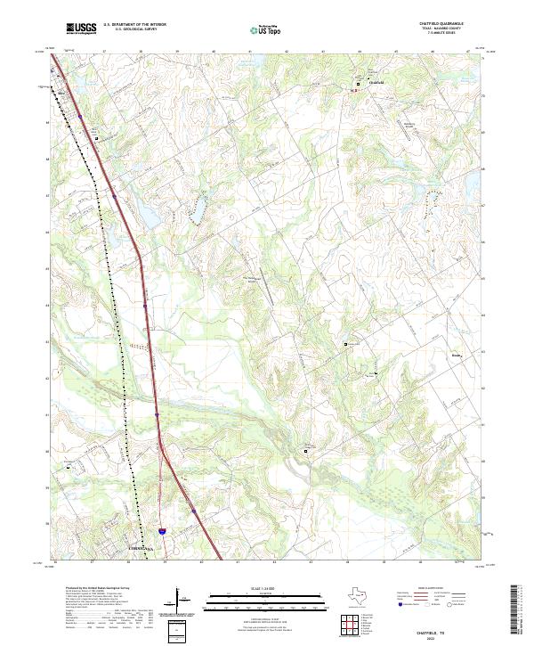
2022 Map of Chatfield
USGS Topo · Published 2022About this map
Chambers Creek and its many tributaries, including Tupelo Br and Post Oak Br, define the low-lying agricultural landscape of northeastern Navarro County. This area, recorded in 2022, is anchored by the small communities of Rice, Chatfield, and Roane, while the northern outskirts of Corsicana appear in the southwest corner. The map is particularly dense with sites for genealogical research, featuring numerous burial grounds such as Old Chatfield Cem, New Chatfield Cem, and the Rice Black Cem.
Find a feature on this map
99 named features on this map. Tap any name to fly to it.
Don’t see what you’re looking for? This feature index may not catch every label — zoom into the map to look around manually.
Map Details
Editions of this 2022 Chatfield Map
This is the sole edition of this map. No revisions or reprints were ever made.
Other maps of this area

1954 · Dallas
USGS Topo · 1:250,000

1956 · Ennis
USGS Topo · 1:62,500

1958 · Dallas
USGS Topo · 1:250,000

1959 · Powell
USGS Topo · 1:24,000

1961 · Chatfield
USGS Topo · 1:24,000

1962 · Bazette
USGS Topo · 1:24,000

1962 · Emhouse
USGS Topo · 1:24,000

1962 · Ennis East
USGS Topo · 1:24,000

1962 · Rosser SW
USGS Topo · 1:24,000
1962 · Styx
USGS Topo · 1:24,000