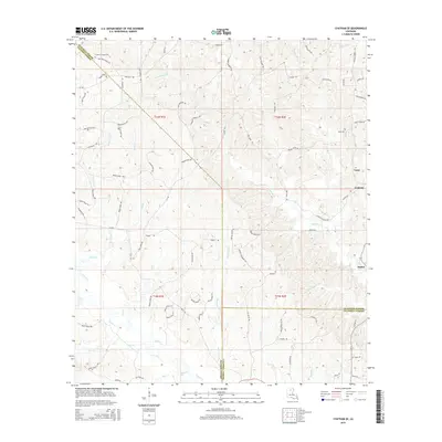
2015 Map of Chatham SE
USGS Topo · Published 2015About this map
The parish lines of Ouachita, Jackson, and Caldwell meet in this part of north-central Louisiana, a landscape defined by an intricate network of waterways draining toward the south. Small settlements like Anabel, Cypress, and Tama are connected by a web of local roads, many bearing family names that speak to the area's genealogical history, including Jack Crowell Rd, Ben Wink Rd, and Henry Moore Rd. The terrain is dominated by the winding paths of Castor Cr and Cypress Cr, which flow through a region primarily characterized by forestry and hunting, evidenced by the R & R Hunting Clb. Significant local landmarks for researchers include Phantom Chapel Cem in the northwest and Head Cem further east, alongside remnants of rural community life such as Cypress School Rd.
Find a feature on this map
90 named features on this map. Tap any name to fly to it.
Don’t see what you’re looking for? This feature index may not catch every label — zoom into the map to look around manually.
Map Details
Editions of this 2015 Chatham SE Map
This is the sole edition of this map. No revisions or reprints were ever made.
Other maps of this area

1940 · Monroe
USGS Topo · 1:62,500

1940 · Columbia
USGS Topo · 1:62,500

1953 · Chatham
USGS Topo · 1:62,500

1954 · Sikes
USGS Topo · 1:62,500

1955 · Shreveport
USGS Topo · 1:250,000

1956 · Shreveport
USGS Topo · 1:250,000

1957 · Columbia
USGS Topo · 1:62,500

1957 · West Monroe South
USGS Topo · 1:24,000

1957 · Monroe South
USGS Topo · 1:62,500

1982 · Chatham
USGS Topo · 1:24,000