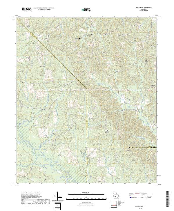
2024 Map of Chatham SE
USGS Topo · Published 2024About this map
Cypress Creek and Hurricane Creek wind through this corner of North Louisiana, where the borderlines of Jackson, Ouachita, and Caldwell parishes converge. The landscape is defined by a dense network of local roads named for established families, including Jack Crowell Rd, Hull George Rd, and Charles Griggs Rd. Small settlements like Tama and Cypress anchor the eastern edge of the sheet, while several rural burial grounds serve as significant genealogical markers for the region. These include the Frantom Chapel Cem in the northwest and the Mount Olive Church Cem further south. The drainage patterns of Little Glade Creek and Little Cypress Creek illustrate the low-lying, water-rich environment of the eastern piney woods, where timber and small-scale agriculture have long shaped the community structure.
Find a feature on this map
79 named features on this map. Tap any name to fly to it.
Don’t see what you’re looking for? This feature index may not catch every label — zoom into the map to look around manually.
Map Details
Editions of this 2024 Chatham SE Map
This is the sole edition of this map. No revisions or reprints were ever made.
Other maps of this area

1940 · Monroe
USGS Topo · 1:62,500

1940 · Columbia
USGS Topo · 1:62,500

1953 · Chatham
USGS Topo · 1:62,500

1954 · Sikes
USGS Topo · 1:62,500

1955 · Shreveport
USGS Topo · 1:250,000

1956 · Shreveport
USGS Topo · 1:250,000

1957 · Columbia
USGS Topo · 1:62,500

1957 · West Monroe South
USGS Topo · 1:24,000

1957 · Monroe South
USGS Topo · 1:62,500

1982 · Chatham
USGS Topo · 1:24,000