
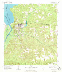
1955 Map of Chattahoochee
USGS Topo · Published 1956About this map
The Chattahoochee region is defined by the strategic confluence of the Flint River and the Chattahoochee River, where they merge to form the Apalachicola River. This mid-century survey captures the landscape following the construction of the Jim Woodruff Dam, which created the Jim Woodruff Reservoir along the Georgia-Florida border. The town itself is dominated by the sprawling complex of the State Hospital, complete with its own State Hospital Cem and Sewage Disposal infrastructure.
Find a feature on this map
36 named features on this map. Tap any name to fly to it.
Don’t see what you’re looking for? This feature index may not catch every label — zoom into the map to look around manually.
Map Details
Editions of this 1955 Chattahoochee Map
2 editions found
Other maps of this area

1954 · Sneads
USGS Topo · 1:24,000

1954 · Tallahassee
USGS Topo · 1:250,000

1955 · Fairchild
USGS Topo · 1:24,000

1955 · Reynoldsville
USGS Topo · 1:24,000

1955 · Rock Bluff
USGS Topo · 1:24,000

1955 · Sycamore
USGS Topo · 1:24,000

1955 · Bainbridge
USGS Topo · 1:62,500

1955 · Mt Pleasant
USGS Topo · 1:24,000

1959 · Tallahassee
USGS Topo · 1:250,000

1959 · Gretna
USGS Topo · 1:24,000