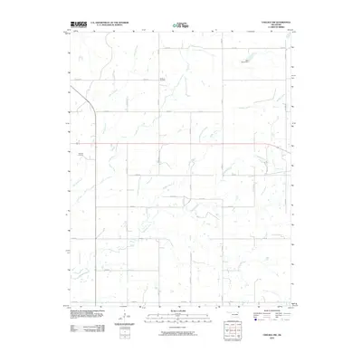
2010 Map of Chelsea NW
USGS Topo · Published 2010About this map
McMains Cemetery and Madden Cemetery sit within the rural grid of northeastern Oklahoma, marking the generational presence of local families in this agricultural landscape. The terrain is defined by a dendritic network of small waterways, most notably Little Salt Creek, Madden Creek, and Lightning Creek, which cut through the open land. Unlike earlier eras of concentrated village life, this 2010 depiction reflects a modern rural pattern of dispersed homesteads connected by a rigorous system of section-line roads, such as E 190 Rd and S 4280 Rd. Evidence of larger-scale ranching or land management appears at Spur Ranch Dam, where the modification of local drainage indicates the importance of water storage in this prairie-fringe environment.
Find a feature on this map
29 named features on this map. Tap any name to fly to it.
Don’t see what you’re looking for? This feature index may not catch every label — zoom into the map to look around manually.
Map Details
Editions of this 2010 Chelsea NW Map
This is the sole edition of this map. No revisions or reprints were ever made.
Other maps of this area

1901 · Nowata
USGS Topo · 1:125,000

1901 · Vinita
USGS Topo · 1:125,000

1913 · Vinita
USGS Topo · 1:125,000

1914 · Nowata
USGS Topo · 1:125,000

1954 · Tulsa
USGS Topo · 1:250,000

1958 · Tulsa
USGS Topo · 1:250,000

1963 · Tulsa
USGS Topo · 1:250,000

1970 · Chelsea
USGS Topo · 1:24,000

1970 · White Oak
USGS Topo · 1:24,000
1970 · Winganon
USGS Topo · 1:24,000