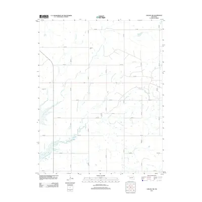
2013 Map of Chelsea NW
USGS Topo · Published 2013About this map
McMains Cem and Madden Cem offer significant touchpoints for genealogists researching family ties in this rural corner of Craig County. This landscape is defined by the network of waterways flowing through the prairie, including Little Salt Cr, Salt Cr, and Lightning Cr. The map reveals a highly structured grid of section roads like e0190 RD and n4240 RD that partition the ranch land, while the Spur Ranch Reservoir in the northeast corner serves as a notable landmark for water management in the region. The map captures the persistent rural character of the area, where small creeks such as Madden Cr weave through large parcels of land, largely undisturbed by urban development.
Find a feature on this map
30 named features on this map. Tap any name to fly to it.
Don’t see what you’re looking for? This feature index may not catch every label — zoom into the map to look around manually.
Map Details
Editions of this 2013 Chelsea NW Map
This is the sole edition of this map. No revisions or reprints were ever made.
Other maps of this area

1901 · Nowata
USGS Topo · 1:125,000

1901 · Vinita
USGS Topo · 1:125,000

1913 · Vinita
USGS Topo · 1:125,000

1914 · Nowata
USGS Topo · 1:125,000

1954 · Tulsa
USGS Topo · 1:250,000

1958 · Tulsa
USGS Topo · 1:250,000

1963 · Tulsa
USGS Topo · 1:250,000

1970 · Chelsea
USGS Topo · 1:24,000

1970 · White Oak
USGS Topo · 1:24,000
1970 · Winganon
USGS Topo · 1:24,000