
1964 Map of Cheney
USGS Topo · Published 1966About this map
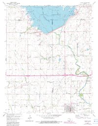
Cheney serves as the primary hub in this mid-1960s Kansas landscape, situated along the tracks of the Atchison Topeka and Santa Fe railroad. The northern portion of the map is dominated by the newly formed Cheney Reservoir, with its normal pool elevation of 1422 feet flooding the valley where the North Fork Ninnescah River once wound freely. This transformation of the terrain reflects a period of significant water management and infrastructure development in the region.
Find a feature on this map
20 named features on this map. Tap any name to fly to it.
Don’t see what you’re looking for? This feature index may not catch every label — zoom into the map to look around manually.
Map Details
Editions of this 1964 Cheney Map
2 editions found
Other maps of this area

1889 · Cheney
USGS Topo · 1:125,000

1891 · Cheney
USGS Topo · 1:125,000

1901 · Cheney
USGS Topo · 1:125,000

1955 · Wichita
USGS Topo · 1:250,000

1958 · Wichita
USGS Topo · 1:250,000

1959 · Mount Hope
USGS Topo · 1:24,000

1965 · Garden Plain
USGS Topo · 1:24,000

1965 · Cheney SE
USGS Topo · 1:24,000
1965 · Waterloo
USGS Topo · 1:24,000
1965 · Castleton
USGS Topo · 1:24,000