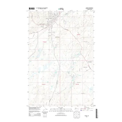
2014 Map of Cheney
USGS Topo · Published 2014About this map
Eastern Washington Univ anchors the northern portion of this landscape, where the city of Cheney transitions into a complex network of wetlands and basalt depressions. The terrain south of the university is defined by a dense concentration of water bodies, including Findley Lake, Isaacson Lake, and the expansive Turnbull Slough. This area reflects a unique geological character where drainage is often contained within local basins like Windmill Pond and McDowell Lake. A prominent transportation corridor is formed by the BNSF Railway, which cuts through the city near the Red Barn landmark. Cultural sites such as Fairview Cem and New England Cem are positioned on the outskirts of the primary settlement. To the southeast, recreational and conservation interests are represented by the 30-Acre Lake Hiking Trail and the Headquarters Trail, which navigate through the Pine Lakes and Phillips Meadow region.
Find a feature on this map
60 named features on this map. Tap any name to fly to it.
Don’t see what you’re looking for? This feature index may not catch every label — zoom into the map to look around manually.
Map Details
Editions of this 2014 Cheney Map
This is the sole edition of this map. No revisions or reprints were ever made.
Other maps of this area

1901 · Spokane
USGS Topo · 1:125,000

1903 · Oakesdale
USGS Topo · 1:125,000

1905 · Oakesdale
USGS Topo · 1:125,000

1943 · Medical Lake
USGS Topo · 1:62,500

1950 · Spokane SW
USGS Topo · 1:24,000

1950 · Spokane
USGS Topo · 1:62,500

1954 · Medical Lake
USGS Topo · 1:24,000

1954 · Medical Lake
USGS Topo · 1:62,500

1954 · Cheney
USGS Topo · 1:62,500

1954 · Spangle
USGS Topo · 1:62,500