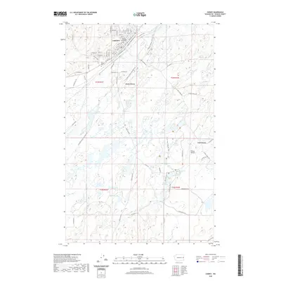
2020 Map of Cheney
USGS Topo · Published 2020About this map
Eastern Washington University serves as a major focal point for the city of Cheney, defining the northern portion of this landscape with its campus grid and street names such as Elm St and Ash St. Moving south from the urban center, the terrain transitions into a complex hydrographic network of scabland lakes and meadows. Significant water bodies like Blackhorse Lake, Isaacson Lake, and the curiously named Winslow Pool are interspersed with drainage features such as the Pine Cr Drain. This area is further characterized by its recreational and historical corridors, notably the Columbia Plateau State Park Trail, which cuts diagonally across the township. Local history is anchored by sites like the New England Cem and small outlying clusters at South Cheney and East Cheney, illustrating the distributed settlement pattern that persists outside the main university town.
Find a feature on this map
77 named features on this map. Tap any name to fly to it.
Don’t see what you’re looking for? This feature index may not catch every label — zoom into the map to look around manually.
Map Details
Editions of this 2020 Cheney Map
This is the sole edition of this map. No revisions or reprints were ever made.
Other maps of this area

1901 · Spokane
USGS Topo · 1:125,000

1903 · Oakesdale
USGS Topo · 1:125,000

1905 · Oakesdale
USGS Topo · 1:125,000

1943 · Medical Lake
USGS Topo · 1:62,500

1950 · Spokane SW
USGS Topo · 1:24,000

1950 · Spokane
USGS Topo · 1:62,500

1954 · Medical Lake
USGS Topo · 1:24,000

1954 · Medical Lake
USGS Topo · 1:62,500

1954 · Cheney
USGS Topo · 1:62,500

1954 · Spangle
USGS Topo · 1:62,500