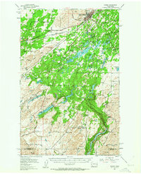
1954 Map of Cheney
USGS Topo · Published 1963About this map
Cheney serves as the focal point of this 1954 field-checked survey, dominated by the campus of the Eastern Washington College of Education. The landscape to the south and west reveals a complex hydrological network within the Turnbull National Wildlife Refuge, where numerous water bodies like Campbell Lake and Hale Lakes are interspersed among the Scablands terrain. A significant rail presence defines the region's transport corridor, with the Northern Pacific, Chicago Milwaukee St Paul and Pacific, and Spokane Portland and Seattle lines all converging or passing through the area.
Find a feature on this map
61 named features on this map. Tap any name to fly to it.
Don’t see what you’re looking for? This feature index may not catch every label — zoom into the map to look around manually.
Map Details
Editions of this 1954 Cheney Map

Other maps of this area

1901 · Spokane
USGS Topo · 1:125,000

1903 · Oakesdale
USGS Topo · 1:125,000

1905 · Oakesdale
USGS Topo · 1:125,000

1943 · Medical Lake
USGS Topo · 1:62,500

1945 · Reardan
USGS Topo · 1:62,500

1950 · Spokane SW
USGS Topo · 1:24,000

1950 · Spokane
USGS Topo · 1:62,500

1953 · Reardan
USGS Topo · 1:62,500

1954 · Medical Lake
USGS Topo · 1:24,000

1954 · Medical Lake
USGS Topo · 1:62,500