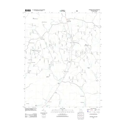
2011 Map of Cherokee Pass
USGS Topo · Published 2011About this map
Cherokee Pass and Central anchor this Madison County landscape, where the headwaters of Twelvemile Creek and East Fork Big Creek carve through a terrain of named hollows and peaks. The map reveals a deeply rooted rural community, evidenced by numerous family and church burial grounds including Revelle Cemetery, Antioch Cemetery, and Settle Cemetery. The geographic layout is defined by prominent elevations such as Matthews Mountain and Clemons Mountain, which separate the various creek valleys. Transportation is dictated by the winding paths of county roads like Madison 411 and Madison 302, which follow the natural contours of the land. Notable landmarks like Whitehurst Lake and Old Mines Hollow suggest a history of resource use and land management in this portion of the Missouri Ozarks.
Find a feature on this map
58 named features on this map. Tap any name to fly to it.
Don’t see what you’re looking for? This feature index may not catch every label — zoom into the map to look around manually.
Map Details
Editions of this 2011 Cherokee Pass Map
This is the sole edition of this map. No revisions or reprints were ever made.
Other maps of this area

1910 · Higdon
USGS Topo · 1:62,500

1930 · Coldwater
USGS Topo · 1:62,500

1933 · Marquand
USGS Topo · 1:62,500

1938 · Marquand
USGS Topo · 1:62,500

1939 · Fredericktown
USGS Topo · 1:48,000

1947 · Fredericktown
USGS Topo · 1:62,500

1949 · Rolla
USGS Topo · 1:250,000

1949 · Coldwater
USGS Topo · 1:62,500

1950 · Fredericktown
USGS Topo · 1:62,500

1953 · Rolla
USGS Topo · 1:250,000