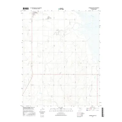
2016 Map of Cherokee South
USGS Topo · Published 2016About this map
Cherokee sits at the northern edge of this Alfalfa County landscape, where the town grid meets the wide, drainage-carved plains of northern Oklahoma. This area is defined by the complex hydrology of the Cimarron River watershed, featuring the branching paths of Clay Cr, E Clay Cr, and W Clay Cr. For genealogists, the map provides precise locations for three distinct burial grounds serving the community: Cherokee Municipal Cem, Cherokee Catholic Cem, and the older Cherokee Cem. The surrounding terrain is meticulously organized by a section-line road network, including e0210 RD and n2630 RD, which navigate the gentle elevation changes near Lambert Cr and Cottonwood Cr. The map captures the agricultural footprint of the region, showing how rural homesteads and local infrastructure are distributed along the drainages of Spring Cr.
Find a feature on this map
31 named features on this map. Tap any name to fly to it.
Don’t see what you’re looking for? This feature index may not catch every label — zoom into the map to look around manually.
Map Details
Editions of this 2016 Cherokee South Map
This is the sole edition of this map. No revisions or reprints were ever made.
Other maps of this area

1955 · Woodward
USGS Topo · 1:250,000

1958 · Woodward
USGS Topo · 1:250,000

1968 · Carmen
USGS Topo · 1:24,000

1969 · Jet
USGS Topo · 1:24,000

1969 · Goltry
USGS Topo · 1:24,000

1969 · Lambert
USGS Topo · 1:24,000

1969 · Helena
USGS Topo · 1:24,000

1969 · Manchester SW
USGS Topo · 1:24,000

1969 · Cherokee North
USGS Topo · 1:24,000

1969 · Ingersoll
USGS Topo · 1:24,000