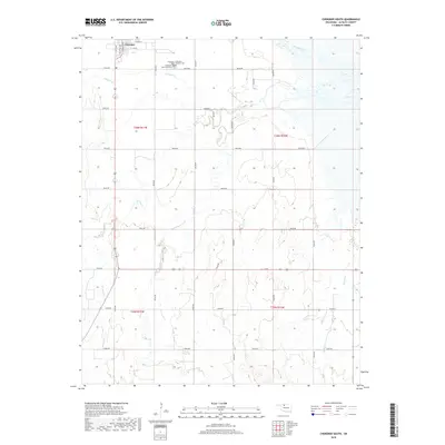
2018 Map of Cherokee South
USGS Topo · Published 2018About this map
The town of Cherokee anchors the northern edge of this Alfalfa County landscape, where the southern outskirts of the settlement give way to an expansive agricultural grid. This area is defined by its drainage patterns, with Lambert Cr and Cottonwood Cr flowing through the northern sections, while Clay Cr, W Clay Cr, and E Clay Cr branch across the central and southern reaches. For genealogists and local historians, several burial grounds are clustered near the town, including Cherokee Cem, the Cherokee Municipal Cem, and the Cherokee Catholic Cem. The map illustrates a highly organized section-line road system, including routes like e0190 RD and n2620 RD, which historically supported the transport of grain and livestock from the surrounding prairie to the rail and market centers in town.
Find a feature on this map
35 named features on this map. Tap any name to fly to it.
Don’t see what you’re looking for? This feature index may not catch every label — zoom into the map to look around manually.
Map Details
Editions of this 2018 Cherokee South Map
This is the sole edition of this map. No revisions or reprints were ever made.
Other maps of this area

1955 · Woodward
USGS Topo · 1:250,000

1958 · Woodward
USGS Topo · 1:250,000

1968 · Carmen
USGS Topo · 1:24,000

1969 · Jet
USGS Topo · 1:24,000

1969 · Goltry
USGS Topo · 1:24,000

1969 · Lambert
USGS Topo · 1:24,000

1969 · Helena
USGS Topo · 1:24,000

1969 · Manchester SW
USGS Topo · 1:24,000

1969 · Cherokee North
USGS Topo · 1:24,000

1969 · Ingersoll
USGS Topo · 1:24,000