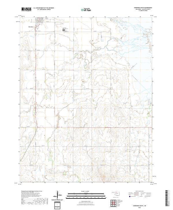
2022 Map of Cherokee South
USGS Topo · Published 2022About this map
The southern outskirts of Cherokee and the surrounding agricultural landscape of Alfalfa County are captured in this 2022 survey. The terrain is defined by a dendritic network of seasonal and perennial waterways including Clay Cr, W Clay Cr, and E Clay Cr, which carve through the plains. Local history is anchored by the Cherokee Municipal Cem and the Cherokee Catholic Cem, located just south of the main town grid. The map illustrates a strict section-line road system characteristic of the Oklahoma prairie, where routes like e0190 RD and n2630 RD facilitate access to the surrounding farmsteads. This document provides a clear view of the intersection between the established town limits and the rural drainage basins of Lambert Cr and Cottonwood Cr.
Find a feature on this map
35 named features on this map. Tap any name to fly to it.
Don’t see what you’re looking for? This feature index may not catch every label — zoom into the map to look around manually.
Map Details
Editions of this 2022 Cherokee South Map
This is the sole edition of this map. No revisions or reprints were ever made.
Other maps of this area

1955 · Woodward
USGS Topo · 1:250,000

1958 · Woodward
USGS Topo · 1:250,000

1968 · Carmen
USGS Topo · 1:24,000

1969 · Jet
USGS Topo · 1:24,000

1969 · Goltry
USGS Topo · 1:24,000

1969 · Lambert
USGS Topo · 1:24,000

1969 · Helena
USGS Topo · 1:24,000

1969 · Manchester SW
USGS Topo · 1:24,000

1969 · Cherokee North
USGS Topo · 1:24,000

1969 · Ingersoll
USGS Topo · 1:24,000