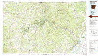
1983 Map of Cherokee Village
USGS Topo · Published 1983About this map
The Strawberry River and Spring River networks dominate this 1980s landscape across the Arkansas-Missouri border, revealing a region defined by its waterway-driven settlement patterns. The planned community of Cherokee Village stands out with its intricate network of man-made lakes, including Lake Thunderbird and Lake Cherokee, contrasted against the older, traditional river towns like Evening Shade and Pocahontas. Further west, the map details the recreation-focused layout of Horseshoe Bend around Crown Lake.
Find a feature on this map
213 named features on this map. Tap any name to fly to it.
Don’t see what you’re looking for? This feature index may not catch every label — zoom into the map to look around manually.
Map Details
Editions of this 1983 Cherokee Village Map
This is the sole edition of this map. No revisions or reprints were ever made.
Other maps of this area

1890 · Batesville
USGS Topo · 1:125,000

1890 · Mountain Home
USGS Topo · 1:125,000

1891 · Mountain Home
USGS Topo · 1:125,000

1891 · Batesville
USGS Topo · 1:125,000

1892 · Mountain View
USGS Topo · 1:125,000

1894 · Mountain View
USGS Topo · 1:125,000

1894 · Mountain Home
USGS Topo · 1:125,000

1932 · Strawberry
USGS Topo · 1:62,500

1932 · Walnut Ridge
USGS Topo · 1:62,500

1934 · Powhatan
USGS Topo · 1:62,500