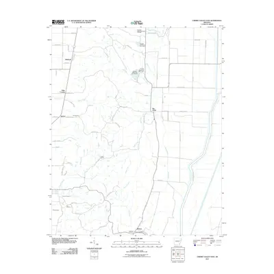
2011 Map of Cherry Valley East
USGS Topo · Published 2011About this map
Birdeye and the Birdeye Post Office anchor the southern portion of this landscape, where the flatlands of the Delta meet the rise of Crowley's Ridge. This 2011 survey reveals a rural network of county roads and drainage systems essential to Arkansas agriculture. The land is defined by numerous waterways, including Sugar Creek, Cooper Creek, and Otter Creek, many of which are managed by structures like the Poinsett Watershed Site 1 Dam.
Find a feature on this map
67 named features on this map. Tap any name to fly to it.
Don’t see what you’re looking for? This feature index may not catch every label — zoom into the map to look around manually.
Map Details
Editions of this 2011 Cherry Valley East Map
This is the sole edition of this map. No revisions or reprints were ever made.
Other maps of this area

1939 · Vanndale
USGS Topo · 1:62,500

1939 · Weiner
USGS Topo · 1:62,500

1940 · Princedale
USGS Topo · 1:62,500

1940 · Dee
USGS Topo · 1:62,500

1953 · Memphis
USGS Topo · 1:250,000

1956 · Memphis
USGS Topo · 1:250,000

1956 · Princedale
USGS Topo · 1:62,500

1958 · Dee
USGS Topo · 1:62,500

1958 · Vanndale
USGS Topo · 1:62,500

1959 · Weiner
USGS Topo · 1:62,500