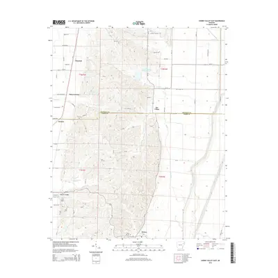
2014 Map of Cherry Valley East
USGS Topo · Published 2014About this map
The town of Cherry Valley serves as a primary hub in this eastern Arkansas landscape, where the boundary between Poinsett Co and Cross Co bisects a terrain of agricultural plains and rolling hills. Small, localized settlements like Whitehall, Bay Village, and Hydrick are connected by a network of county roads such as Wiley Crossing Rd and Distress Creek Rd. The presence of numerous family and community burial grounds, including Bowers Cem, Halk Cem, and Tyer Cem, offers significant detail for those tracing local lineages. Water drainage patterns define much of the topography, with Hydrick Cr, Otter Cr, and Sugar Cr flowing through the countryside. The Poinsett Watershed Site One Reservoir stands out as a significant water management feature in the northern portion of the map, illustrating how the region's hydrology was adapted for local utility.
Find a feature on this map
52 named features on this map. Tap any name to fly to it.
Don’t see what you’re looking for? This feature index may not catch every label — zoom into the map to look around manually.
Map Details
Editions of this 2014 Cherry Valley East Map
This is the sole edition of this map. No revisions or reprints were ever made.
Other maps of this area

1939 · Vanndale
USGS Topo · 1:62,500

1939 · Weiner
USGS Topo · 1:62,500

1940 · Princedale
USGS Topo · 1:62,500

1940 · Dee
USGS Topo · 1:62,500

1953 · Memphis
USGS Topo · 1:250,000

1956 · Memphis
USGS Topo · 1:250,000

1956 · Princedale
USGS Topo · 1:62,500

1958 · Dee
USGS Topo · 1:62,500

1958 · Vanndale
USGS Topo · 1:62,500

1959 · Weiner
USGS Topo · 1:62,500