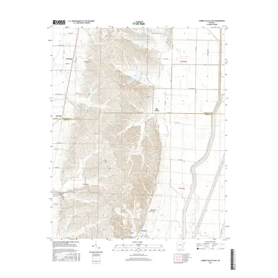
2017 Map of Cherry Valley East
USGS Topo · Published 2017About this map
Cherry Valley and the surrounding Arkansas ridge country are detailed here during a period of modern agricultural management and preservation. The landscape is defined by the complex drainage of Crowley's Ridge, where numerous waterways like Sugar Creek, Halk Creek, and Hydrick Creek carve through the terrain before reaching the flatter eastern plains. A significant portion of the northern area is dedicated to water control, featuring the Poinsett Watershed Site 102 Reservoir and Poinsett Watershed Site Two Reservoir.
Find a feature on this map
68 named features on this map. Tap any name to fly to it.
Don’t see what you’re looking for? This feature index may not catch every label — zoom into the map to look around manually.
Map Details
Editions of this 2017 Cherry Valley East Map
This is the sole edition of this map. No revisions or reprints were ever made.
Other maps of this area

1939 · Vanndale
USGS Topo · 1:62,500

1939 · Weiner
USGS Topo · 1:62,500

1940 · Princedale
USGS Topo · 1:62,500

1940 · Dee
USGS Topo · 1:62,500

1953 · Memphis
USGS Topo · 1:250,000

1956 · Memphis
USGS Topo · 1:250,000

1956 · Princedale
USGS Topo · 1:62,500

1958 · Dee
USGS Topo · 1:62,500

1958 · Vanndale
USGS Topo · 1:62,500

1959 · Weiner
USGS Topo · 1:62,500