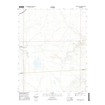
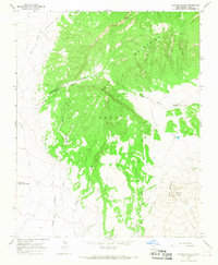
2017 Map of Cherry Valley Lake
USGS Topo · Published 2017About this map
Cherry Valley Lake and the meandering Mora River dominate this high-plains landscape where San Miguel and Mora counties meet. The settlement of Shoemaker sits near the western edge, adjacent to a network of irrigation infrastructure including the Company Ditch and S Company Ditch. This system highlights the vital role of water management in this arid region, where the river's path is carved through deep contours. Genealogy and local history researchers will find the Cherry Valley Cem south of Shoemaker, positioned along State Hwy 97. Further east, a distinct bend in the river surrounds a landform known as The Island, while Pedroso Cr drains the southern territory. The map illustrates the sparsely populated but geographically complex borderlands of northeast New Mexico.
Find a feature on this map
10 named features on this map. Tap any name to fly to it.
Don’t see what you’re looking for? This feature index may not catch every label — zoom into the map to look around manually.
Map Details
Editions of this 2017 Cherry Valley Lake Map
This is the sole edition of this map. No revisions or reprints were ever made.
Other maps of this area

1892 · Watrous
USGS Topo · 1:125,000

1894 · Watrous
USGS Topo · 1:125,000

1954 · Santa Fe
USGS Topo · 1:250,000

1958 · Santa Fe
USGS Topo · 1:250,000

1964 · Frutosa Lake
USGS Topo · 1:24,000

1964 · Mogote Hills
USGS Topo · 1:24,000
1966 · Watrous
USGS Topo · 1:24,000
1966 · Cherry Valley Lake
USGS Topo · 1:24,000
1966 · Optimo
USGS Topo · 1:24,000
1966 · Maxson Crater
USGS Topo · 1:24,000