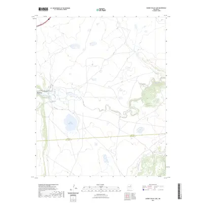
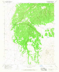
2023 Map of Cherry Valley Lake
USGS Topo · Published 2023About this map
The Mora River winds through the heart of this high-plains landscape where the boundary between Mora and San Miguel counties cuts across the open terrain. Human settlement is anchored at Shoemaker and the community of Cherry Valley, which is served by the Cherry Valley Cem. The map illustrates a critical reliance on water management in this arid region, evidenced by the North Company Ditch and South Company Ditch that parallel the river's path to support local agricultural needs. Central to the geography is Cherry Valley Lake, while more rugged terrain is found to the east at a distinctive landform known as The Island. Roads like State Hwy 97 and State Hwy 450 provide the primary connections through this quiet ranching and farming corridor.
Find a feature on this map
12 named features on this map. Tap any name to fly to it.
Don’t see what you’re looking for? This feature index may not catch every label — zoom into the map to look around manually.
Map Details
Editions of this 2023 Cherry Valley Lake Map
This is the sole edition of this map. No revisions or reprints were ever made.
Other maps of this area

1892 · Watrous
USGS Topo · 1:125,000

1894 · Watrous
USGS Topo · 1:125,000

1954 · Santa Fe
USGS Topo · 1:250,000

1958 · Santa Fe
USGS Topo · 1:250,000

1964 · Frutosa Lake
USGS Topo · 1:24,000

1964 · Mogote Hills
USGS Topo · 1:24,000
1966 · Watrous
USGS Topo · 1:24,000
1966 · Cherry Valley Lake
USGS Topo · 1:24,000
1966 · Optimo
USGS Topo · 1:24,000
1966 · Maxson Crater
USGS Topo · 1:24,000