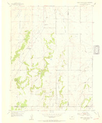
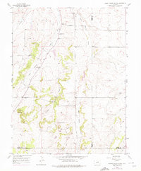
1954 Map of Cherry Valley School
USGS Topo · Published 1955About this map
Cherry Valley School anchors this rural landscape where the headwaters of the Cherry Creek system converge near the intersection of Douglas, Elbert, and El Paso counties. The mid-century geography is defined by a dendritic network of drainages, including Antelope Creek, West Cherry Creek, and East Cherry Creek, which carve through the high plains terrain. A notable shift in local educational infrastructure is evident, with the active schoolhouse standing in contrast to the nearby Cherry Sch (Aband) and Pine Grove Sch (Aband), reflecting a period of rural consolidation. The terrain rises toward Bucks Mountain in the west, while specialized transportation routes like a Jeep Trail suggest a rugged landscape often accessed by early utility or off-road vehicles. Family-named landmarks such as Neffs Gulch and the winding course of Iron Gulch provide specific points of interest for those studying the early ranching and agricultural patterns of this tri-county border region.
Find a feature on this map
18 named features on this map. Tap any name to fly to it.
Don’t see what you’re looking for? This feature index may not catch every label — zoom into the map to look around manually.
Map Details
Editions of this 1954 Cherry Valley School Map
6 editions found
Other maps of this area

1894 · Castle Rock
USGS Topo · 1:125,000

1913 · Castle Rock
USGS Topo · 1:125,000

1939 · Elizabeth
USGS Topo · 1:62,500

1940 · Elbert
USGS Topo · 1:62,500

1940 · Castle Rock
USGS Topo · 1:62,500

1944 · Elbert
USGS Topo · 1:62,500

1945 · Castle Rock
USGS Topo · 1:62,500

1945 · Elizabeth
USGS Topo · 1:62,500

1953 · Denver
USGS Topo · 1:250,000

1954 · Cherry Valley School
USGS Topo · 1:24,000